Nusa Tenggara
West-Nusa Tenggara
Die Wallace-Linie, benannt nach dem Naturforscher Alfred Russell Wallace, markiert den Übergang zwischen der Flora und Fauna des Westens und des Ostens Indonesiens und ist gleichzeitig die westliche Grenze von West-Nusa Tenggara. Zu dieser Inselgruppe gehören auch die Inseln Lombok und Sumbawa.
Lombok unterscheidet sich deutlich vom benachbarten Bali. Der nördliche Teil der Insel ist gebirgsreich und üppig bewachsen. Der Süden dagegen ist trocken und gleicht eher einer Savanne. Statt großer asiatischer Säugetiere gibt es hier kleinere Tiere wie Beuteltiere, Eidechsen, Kakadus und Papageien. Weiter im Osten Lomboks wird der Unterschied zu Bali noch offensichtlicher. Hier sind die Trockenzeiten sehr lang. Getreide und Maniok, nicht Reis, sind die Haupterzeugnisse dieser Region.
Als der Islam die Inseln des heutigen West-Nusa-Tenggara erstmals erreichte, koexistierten dort vier Hindu-Königreiche in Frieden miteinander. Lombok wurde zwar stark von Bali beeinflusst, bewahrte jedoch seine eigene Identität. Die Ureinwohner Lomboks, die Sasak, sind überwiegend Muslime und haben wie die Bewohner der Nachbarinsel Sumbawa starke Traditionen.
Mit seinen weiche weißen Sandstränden ist Lombok immer noch ein Geheimtipp. Hier gilt das Motto: “Man kann Bali von Lombok aus sehen, aber Lombok nicht von Bali aus.” Die Insel, die vor allem für ihre handgewebten Ikatstoffe bekannt ist, hat einen außergewöhnlichen Charme und ist zum großen Teil noch relativ unerschlossen. Ausnahme ist der Badeort Senggigi. Mit Linienflügen aus Bali und Surabaya oder per Fähre ist Lombok exzellent mit den anderen Inseln der Provinz und dem Rest Indonesiens verbunden.
Ost-Nusa Tenggera
Die Inselgruppe Ost-Nusa Tenggara wurde durch die Kraft und die Gewalt der mächtigen Vulkankette, die nördlich von Sumatra beginnt und sich östlich bis nach Java streckt, geteilt. Die Provinz besteht aus mehr als 500 Inseln. Die drei Hauptinseln sind Flores, Sumba und Timor. Die trockene Landschaft Ost- und Süd-Nusa-Tenggeras ist das Ergebnis der heißen und trockenen Winde, die vor dem australischen Kontinent wehen. In vielen Küstengebieten fallen im Jahr kaum Niederschläge. Der Name Flores ist portugiesisch und bedeutet Blume und beschreibt passend die Schönheit des Ortes. Diese lange Insel zwischen Sumbawa und Timor ist voller Vulkane und Gebirge. Die Insel ist in mehrere Regionen unterteilt, die unterschiedliche Sprachen und Traditionen haben. Wegen dem starken Einfluss Portugals ist der Katholizismus die Hauptreligion. Es gibt sehr viele Beispiele, die das europäische Kulturerbe zeigen, wie z.B. das Osterfest in Larantuka und die königlichen Insignien des früheren Königs in Maumere.
Früher bekannt als die Sandelholzinsel, ist Sumba heutzutage vor allem wegen seiner Pferde und seiner herrlichen Ikatstoffe berühmt. In Westsumba gibt es beeindruckende Megalith-Gräber und Stelzenhäuser. Unglaubliche Rituale gehören hier zum Leben, wie z.B. die “Pasola”, wo hunderte von Reitern sich in einer traditionellen Zeremonie gegenseitig mit Speeren bewerfen. Die meisten Rituale finden zwischen Juli und Oktober statt, so auch der Bau der traditionellen „adat“-Häuser. Für Beerdigungszeremonien werden Hunderte Schweine, Wasserbüffel und Hunde geopfert. Andere Zeremonien sind z.B. die “Pajura”, das traditionelle Boxen, das Lunar-Neujahrfest im Oktober und November, Pferderennen und rituelle Tänze.
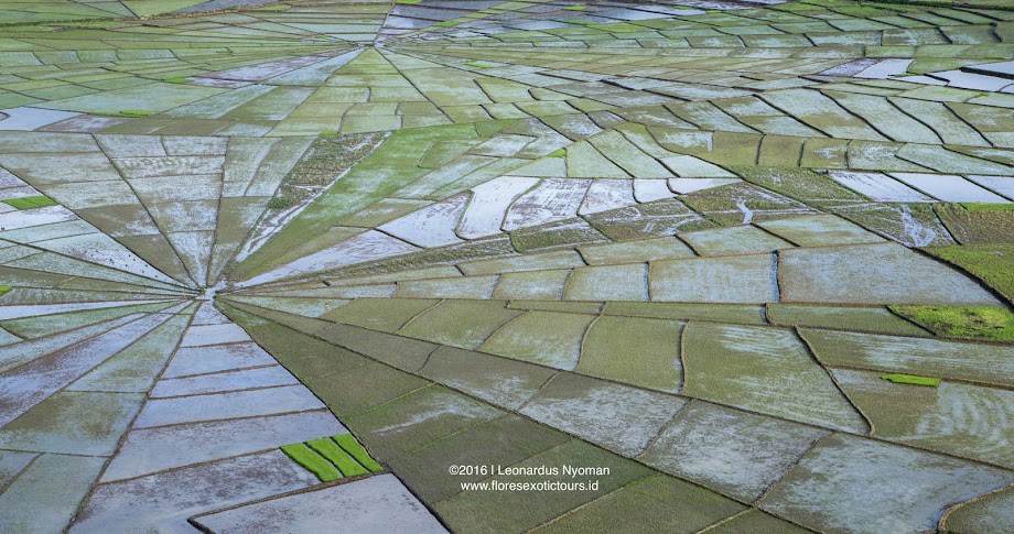
Discovering Indonesia beyond Bali KOMODO | FLORES | SUMBA | WEST TIMOR | ALOR - adventure tours - Photography tours - Eco-tours - Cycling. www.floresexotictours.id - www.komododragontours.com
Monday, November 15, 2010
Wednesday, November 10, 2010
Flores, Community based eco-tourism
Waerebo Traditional Village of Manggarai
West Flores
Administratively, Waerebo is within the Todo Forest area, Satarlenda Village, West Satarmese District, Manggarai Region, Flores NTT Province. It is 158 km from Labuan Bajo, the major town of West Manggarai and 88 km from Ruteng, the major town of the Manggarai Region. Add to this another 9 km walk, which can take up to approximately 5 hours.
Tourist Visits
A total of 300 recorded tourists had visited Waerebo Traditional Enclave by 2008 (source: LPW). The majority of these visitors were Dutch and used one of a few travel agents.
Waerebo is the only remaining village in the original style of round houses with straw rooves (mbaru niang) in the whole of Manggarai. Visitors will enjoy an interactive experience while learning about community lifestyle in previous times.
Community Based Tourism Assistance Mode
To establish community based tourism in Waerebo traditional enclave, NGO BirdLife Indonesia implemented a facilitation model designed to increase the capacity of human resources and improve the local economy through environmental conservation. This method involved small groups forming the Waerebo Tourism body with 20 male and 15 female members.
1.Assistance activities include:
Awareness Building and Learning About Tourism
This program includes learning methods for the local community, especially group members, about how to identify potential, plan and develop a product that is appealing to tourists and is based in environmental conservation. Activities are as follows:
Group discussion about tourism and culture
Cleaning up the environment - "No Plastic" campaig
English language training
2.Building Capacity of the Local Community
In developing community based tourism, NGO BirdLife Indonesia also provided hospitality training to groups. Activities included:
Service training
Tourist Guide training
Local Food training
Preparing Homestays and the Home Environment training
Grass Weaving training
Art and Culture training
3.Participative Tourism Facilities Provision
Tourism development requires tourism facilities, as in every tourism activity people need accommodation, food, drink and information. NGO BirdLife Indonesia ensures facilities development involves the community and is carried out in a participative manner. The outcome of this is for the community to maintain the facilities into the future. Facilities include clean water, an eco-tourism trail to Warebo and a billboard advertising the potential of Waerebo at cross-roads in Pela and Dintor.
Lake Sano Nggoang , West Flores Indonesia
•Administrative Site
For administrative purposes, Lake Sano Nggoang is located in Wae Sano village, Sano Nggoang district, West Manggarai. It is 63 kilometres from Labuan Bajo and takes about 3 hours by car or motorbike. Between Labuan Bajo and Werang - the major village of Sano Nggoang district – the road is asphalt, from Werang to Lake Sano Nggoang is is a stone road. However, a current project to asphalt the surface to Lake Sano Nggoang will improve tourist access.
•Tourist visits
The total number of tourist visits to the area of Lake Sano Nggoang in 2008 was just 30 and in 2009 this increased to a total of 175 (source: Lake Sano Nggoang Ecotourism Group). There were 20,634 international visitors to Labuan Bajo in 2007 as well as 11,123 domestic tourists.
Tourism potential of Lake Sano Nggoang Area
Lake Sano Nggoang is located 750m above sea level, south east of Mbeliling Fores in the separate Sesok Forest block. Tourism potential in the area is as follows:
Volcanic Lake
The lake has an area of approximately 513 há, 2.5 and 3 kilometres wide, and a depth of ±600m. The lake has sulphuric content high enough for activites related to skin health, revitalisation and can be circled by horse back. Lake Sano Nggoang is in a still natural area and when viewed from above at a distance of 150 metres its beauty is two-fold.
Hot Springs and Sulphur
Around Lake Sano Nggoang are hot springs up to 100 degrees Farenheit / 37 degrees Celsius with true natural value. The real attraction here is the water being hot enough to cook eggs and bananas in just 3 minutes. Visitors can also experience a Natural Spa in a small pool near the lakes' edge.
Flores Endemic Birds (Flores Crow)
Bird species found in the region of Lake Sano Nggoang include: Teals (Anas superciliosa, Anas gibberifrons); endemic Flores crow species (Corvus florensis); Swamp species (Tesia everetti, Rhipidura diluta, Caridonax fulgidus). Lake Sano Nggoang is attractive as a bird watching location with a high population of birds in the region.
Natural Medicine
In Sesok Forest natural medicine is often used by the local community for fever, flu, malaria, pregnancy and cancer. These medicines can be seen while trekking.
Ecotourism Savanna Peak
Trekking to Savanna Peak is short but steep. From the peak, the lake, Mbeliling Forest and a number of small islands can be seen. It is also possible to enjoy traditional coffee and local food at the peak.
Religious Tourism
There is a picturesque, old wooden church at Lake Sano Nggoang and parish houses. The church has never been renovated and is maintained in its original condition.
Tourism Facilities
Tourism facilities at Lake Sano Nggoang are relatively limited as development of infrastructure will require an environmental impact assessment to ensure the environment is not damanaged in the development process. Facilities in existence are:
Home Stays,Birdwatching equipment,Information board
Community-based Tourism Model
To optimise the potential of tourism in the Lake Sano Nggoang area, NGO BirdLife Indonesia implemented a facilitation model to increase the quality of local community resources through community participation in tourism development that contributes to improving the local economy, conserving the environment and educating community members and tourists about the environment. This work is undertaken with the Lake Sano Nggoang Ecotourism Group made up of 15 people. These members represent Nunang and Lempe communities and work without self-interest for the preservation and sustainability of Lake Sano Nggoang. For the time being BirdLife Indonesia has only implemented ecotourism facilitation with these two communities. These activities started in September 2008 are as follows:
1.Tourism Awareness and Training
This program involves training the community, especially ecotourism gorup members, about how to realise potential, plan, make products and market them to tourists with a basis in the value of environmental conservation. Activities being implemented are:
Group discussions about tourism and culture
Cleaning up the environment - 'No Plastic' campaign
English language training
2.Tourism Management Training
To create community-based tourism, NGO BirdLife Indonesia also give the ecotourism group training in providing satisfactory service to tourists. This training involves:
Hospitality
Guiding
Local food
Homes tay and room structure
Cane work
Art and culture
3.Participative Tourism Facilities Provision
Tourism development can not be separated from the provision of tourist facilities. In all activities tourists undertake, they require accommodation, refreshments and information. Tourism facilities provision implemented by Burung Indonesia incorporates community involvement for the sake of maintaining/guarding infrastructure. Facilities such as rubbish bins, home stays, tourism awareness board and bird watching equipment (e.g. Binoculars).
Friday, November 5, 2010
Gewaltige-Eruption-am-Vulkan-Merapi-49-Tote
Die Region um den indonesischen Vulkan Merapi kommt nicht zur Ruhe. Beim schwersten Ausbruch seit 100 Jahren gab es zahlreiche Opfer.
Der Ausbruch des Vulkans Merapi
Foto: AFP Bei der bislang schwersten Eruption hat der Merapi Asche bis zu zehn kilometerweit geschleudert.
Bei dem bislang schwersten Ausbruch des Vulkans Merapi auf der indonesischen Insel Java sind am Freitag nach Krankenhausangaben mindestens 49 Menschen ums Leben gekommen. Wie ein Sprecher des Sarjito-Krankenhauses in der Stadt Yogyakarta sagte, wurden zudem 66 Menschen wegen Verbrennungen und Atemproblemen behandelt. Insgesamt starben seit vergangener Woche mehr als 90 Menschen durch die Ausbrüche des Merapi.
Nach Behördenangaben verbrannte die heiße Vulkanasche umliegende Dörfer bis in 18 Kilometer Entfernung. Rettungskräfte vermuteten, dass unter den Opfern viele Kinder aus dem 18 Kilometer vom Vulkan entfernten Argomulyo waren. „Das Dorf Argomolyo brannte vollständig nieder“, sagte der Polizeiarzt Teguh Dwi Santosa. „Viele Kinder starben dort. Als ich in dem Dorf war, war der Boden noch heiß.“
Merapi bricht erneut gewaltig aus
Der schwere Ausbruch mitten in der Nacht habe Panik unter den Anwohnern des Merapi ausgelöst, sagte der Koordinator der Rettungsmaßnahmen, Widi Sutikno. „Alle zur Verfügung stehenden Verkehrsmittel wurden genutzt, um die Menschen in Sicherheit zu bringen.“
Das Sperrgebiet wurde nach dem erneuten Ausbruch am Freitag von 15 auf 20 Kilometer erweitert. Die Anwohner in einem Umkreis von 20 Kilometern um den Merapi mussten ihre Häuser verlassen. Erst am Mittwoch war die Sperrzone wegen der erhöhten Aktivität des Vulkans von zehn auf 15 Kilometer vergrößert worden. Seitdem stieg die Zahl der in Notunterkünften untergebrachten Menschen von 75.000 auf 100.000. „Die Notunterkünfte sind jetzt überfüllt“, sagte Sutikno.
Vulkanausbrüche in der Geschichte
________________________________________
Seit Jahrhunderten bringen Vulkanausbrüche Flutwellen, Ascheregen, Brände und Flüchtlingselend über die Menschen. Jährlich werden rund 50 Vulkane in unberechenbarem Rhythmus tätig. Beispiele für folgenschwere Vulkanausbrüche: ...
Dezember 2009 Mayon, Philippinen
________________________________________
Bei einem Ausbruch sterben mindestens vier Menschen, Tausende sind auf der Flucht. Bereits 2000 und 2001 mussten bis zu 61 000 Menschen vor den Aktivitäten des Feuerbergs in Sicherheit gebracht werden.
2008 Tungurahua, Ecuador
________________________________________
Bei einem Ausbruch sterben zehn Menschen. Seit 1999 stößt der Vulkan immer wieder Lava und Asche aus.
2002 Nyiragongo, Kongo
________________________________________
Etwa 89 Menschen kommen ums Leben, als Lavamassen die Stadt Goma und angrenzende Dörfer zerstören.
2000 Popocatepetl, Mexiko
________________________________________
Nach dem schwersten Ausbruch des Vulkans seit 500 Jahren werden zehntausende Menschen in Sicherheit gebracht.
1997 Soufrière, Montserrat
________________________________________
Die Hauptstadt der Karibikinsel, Plymouth, wird zerstört, Dutzende Einwohner sterben.
1994 Merapi, Indonesien
________________________________________
Die meisten der fast 70 Todesopfer sterben durch glühend heiße Gaswolken.
1991 Pinatubo, Philippinen
________________________________________
Einer der schwersten Ausbrüche des Jahrhunderts fordert bis zu 1000 Menschenleben.
1986 Nios, Kamerun
________________________________________
Eine Giftgaswolke aus dem Kratersee tötet nahezu 1800 Anwohner.
1985 Nevado del Ruiz, Kolumbien
________________________________________
Bis zu 25 000 Menschen sterben in Schlammlawinen.
1980 St. Helens, USA
________________________________________
Bei einem Ausbruch wird die Gipfelspitze weggesprengt, 57 Menschen sterben. Eine riesige Aschewolke umkreist die Erde.
1902 Montagne Pelee, Martinique
________________________________________
Bis zu 30 000 Menschen werden durch Auswurf und eine Glutwolke getötet.
1883 Krakatau, Indonesien
________________________________________
Rund 70 000 Tote sind zu beklagen, Aschewolken verdunkeln weite Teile der Erde.
1815 Tambora, Indonesien
________________________________________
Bei dem folgenschwersten Vulkanausbruch der Geschichte werden mehr als 100 Kubikkilometer Gestein ausgeworfen. Etwa 10.000 Menschen sterben gleich, weitere 80 000 später an Hungersnöten und Krankheiten.
1792 Unzen, Japan
________________________________________
Der Ausbruch zieht Erdbeben und eine Flutwelle nach sich, rund 15 000 Menschen sterben.
1669 Ätna, Italien
________________________________________
Lava und Erdbeben töten etwa 20 000 Menschen.
1631 und 79 n. Chr., Italien
Wednesday, November 3, 2010
Lake Kelimutu Flores Indonesia
Kelimutu is a volcano, close to the town of Moni in central Flores Island of Indonesia containing three summit crater lakes of varying colors. Tiwu Ata Mbupu (Lake of Old People) is usually blue and is the westernmost of the three lakes. The other two lakes, Tiwu Nuwa Muri Koo Fai (Lake of Young Men and Maidens) and Tiwu Ata Polo (Bewitched or Enchanted Lake) are separated by a shared crater wall and are typically green or red in color, respectively. The lake colors do vary on a periodic basis. Subaqueous fumaroles are the probable cause of active upwelling that occurs at the two eastern lakes.[1]
The lake have been a source of minor phreatic eruptions in historical time. The summit of the compound 1639-m-high Kelimutu volcano is elongated two km in a WNW-ESE direction; the older cones of Kelido and Kelibara are located respectively three km to the north and two km to the south. The scenic lakes are a popular tourist destination. Keli Mutu is also of interest to geologists because the three lakes are different colors yet reside at the crest of the same volcano [2].
The closest airports are Maumere, and Ende. There are regular flights to Maumere from Bali.
The drive from Maumere to Moni, the town at the base of Keli Mutu, takes about 3 hours.
Indonesian setting
Indonesia is one of the world's most geologically active countries. Given its combination of active volcanism and tropical climate, it is home to several volcanoes which exemplify the type of dynamic interactions between the forces of the endosphere and exosphere that are characteristic of volcanic lake environments. Of all the volcanos in Indonesia, Keli Mutu on the island of Flores appears to have the most exotic lakes. In fact, its lakes are so brightly colored that they are featured on the 5,000 rupiah bill and thought of as a national treasure by the people of Indonesia.
Located between Malaysia and Australia, the islands comprising the approximately 3,000 mile long latitudinal axis of Indonesia are the physical expression of the subduction of the Indo-Australian plate to the south beneath the Eurasian plate to the north. Typical features of such "island arcs" are andesitic stratovolcanoes. These volcanoes may either be 1) well-developed lofty cones (e.g. Merapi in central Java) or 2) complex structures featuring mutiple craters and irregular moonscape summits sculpted by alternate periods of building up and destruction (e.g. Una-Una in Celebes) (Umbgrove, 1949). The active stratovolcanoes of Indonesia are particularly well known for their highly explosive eruptions, devastating lahars (mud-flows), and associated tsunami waves. Currently there are more than 200 active and many more extinct volcanoes present in Indonesia.
Because Indonesia straddles the equator it does not have temperature-defined seasons. The year-round average monthly temperature is ~80 deg F and the average rainfall is ~3 m/year (Ulack & Pauer, 1989). Those islands that deviate to the north or south of the equator may experience monsoons, while those that are closer to Australia are subject to a more pronounced dry season. Where present, the dry season spans from August through part of October and is immediately followed by a wet season that eventually winds down in March. Striking seasonal variations in precipitation along the latitudinal axis of Indonesia were first described by the naturalist George Wallace (co-founder of the theory of evolution by natural selection) in the mid 1800's.
Keli Mutu Setting
Keli Mutu is a passively degassing stratovolcano (Fig.1) capped by three crater lakes (Fig. 2) containing exotic fluids and whose physico-chemical expressions have changed dramatically through the years. The volcano is located on Flores, an island along the Lesser Sunda islands chain of Indonesia. An early description of Keli Mutu was provided by the French naturalist LeRoux, who mentions it in his travel log of eastern Indonesia in 1896. A more comprehensive geologic and topographic survey was performed in the 1920's by the Dutch colonial geologist Kemmerling, who traveled through Flores on horseback and early motor vehicle. Since 1929 no publicly reported systematic survey of Flores has been done using modern techniques. A map of Flores (TPC N-12BG) was published in 1972 as part of the World Aeronautical Chart (WAC) series, but the topographic information is sketchy.
Keli Mutu Crater Lakes
Three crater lakes are located on the eastern summit of Keli Mutu. Each of the lakes has a distinctive physical structure, a unique geochemical and hydrothermal regime, and a particular historical sequence of color changes controlled by changes in physico-chemical conditions.
Tiwu Ata Polo (TAP), the "enchanted lake", lies on the southeastern side of the volcanic peak (Fig.3). A thermal plume in the northwest part of the lake indicates underlying subaerial fumarolic or hydrothermal activity. A white froth is present on the lake's surface around the plume when the convective activity momentarily increases. Rock debris is often carried into TAP during rainstorms by water draining the volcano summit around the lake. Two peaks abutting the crater rim help stabilize the east and northeast crater wall, while further around to the southeast a dip suggests a possible one-time overflow outlet. Such an outlet would have fed the river Ria Mbuli, whose upland source is in that area.
Tiwu Nua Muri Koohi Fah (TiN), the "lake of young men and maidens", is adjacent to TAP and is the deepest lake (Fig.4). A sizable tear in the western wall was the location of a pre-1929 breaching and overflow event. Visible fumarolic activity above the shoreline of TiN was reported by Kemmerling, but this activity has declined and is no longer present. Subaerial fumarolic or hydrothermal activity is implied by a large thermal plume in the center of the lake which slowly convects the water. A fresh supply of yellow froth (probably the same type of elemental sulfur found in the "cool acid-brine" crater lake at Kawa Ijen) is brought up by the plume and pushed out toward the crater wall. A particularly large cover of this froth has accumulated at the base of the north wall (Fig.4). During rainstorms the froth is scattered by inflowing water and landslides, though some of it may be disappearing altogether.
TAP and TiN are only separated by a steep parabolic partition that arcs down to a minimum height of ~35m above the surface level of the lakes (Fig.3). According to Kemmerling this separating wall was as high as the surrounding crater rim 70 years before his survey, but it had subsequently eroded down by the time of his visit (Kemmerling, 1929). Recent unconfirmed reports (1996) state that the partition has crumbled and the lakes are now mingled. A directory of volcanoes published by the Smithsonain Institute lists moderate "hydrothermal blasts" of TiN that occured in 1938 and again in 1965. Each of these events was reported to have lasted longer than a month but was small and confined to the crater (Simkin et al, 1981).
Tiwu Ata Mbupu (TAM), the "lake of elders", is the western-most lake (Fig. 5). TAM is structurally different from the other two in that the pit crater it is in is itself located in the center of a larger crater. Kemmerling reported both aerial and subaerial fumarolic activity for the TAM crater, but none was observed in 1992. Small landslides constantly add to the steep rubble slopes along the lake's shore, and large boulders periodically drop into the lake. TAM's shoreline is coated with a film colored in different shades of red, orange, and yellow depending on how thick it is. Gypsum crystals grow in the cracks of the crater wall in the first few meters above the prosent water surface.
Research at Keli Mutu
Geochemical surveys and subsequent analyses of the lakes on Keli Mutu have been carried out recently by scientists from Wesleyan University (Middletown, CT, USA). Results have been published in
Pasternack, G.B. (1993) Acid-brine crater lakes: a case study. Undergraduate senior thesis, Wesleyan University, 160 pp.
Pasternack, G.B. and Varekamp, J.C. (1994) The geochemistry of the Keli Mutu crater lakes, Flores, Indonesia, Geochemical Journal 28:243-262.
reprint requests to: gpast@jhu.edu
The work involved describing the chemistry of each lake, interpreting the chemistries in terms of water-rock interactions and volcanic fluxes, and deriving a physical lake model that delineates the parameter-window for volcanic crater lake existence.
Geochemical investigation of the vertical and lateral compositions of the lakes on Keli Mutu required the use of a remote sampling system. Lake temperature, pH, and dissolved oxygen content were determined in the field, while the analytical chemistries of lake fluids and sediments were determined in the months after the expedition to Keli Mutu. To reconstruct the in situ chemistries of the lakes' aqueous systems, a solution equilibrium modeling program (SOLVEQ) was applied.
The primary conclusion of the work at Keli Mutu is that the three Keli Mutu lakes are all fed by a similar volcanic gas source, but as a result of the mediated subaqueous transport of that gas it yields different chemical "expressions" in each crater lake. Specific findings include the following:
• Tiwu Ata Polo (TAP) is an intermediate "acid-saline" volcanic crater lake whose frequent color changes are probably the direct result of changes in the oxidation state of the lake's water. TAP is intermediate in volcanic activity relative to the other Keli Mutu lakes.
• Tiwu Nua Moori Koohi Fah (TiN) is a "cool acid-brine" volcanic crater lake that contains exotic sulfur compounds and probably a host of copper-rich minerals in the sediments. Of the three Keli Mutu lakes, TiN is presently experiencing the greatest fumarolic input, which may include a flux of ~85 tonnes of sulfur dioxide per day (~55MW energy output).
• Tiwu Ata Mbupu (TAM) is an "acid-sulfate" volcanic crater lake whose gaseous input is presently very small relative to those for the other Keli Mutu lakes. In the 1970s it appears that TAM was much more active than it presently is.
• Comparison of the individual lakes with their respective historic chemistries demonstrates that they are all approaching chemical steady state.
• Several seepage outlets exist on and around Keli Mutu. The river Watu Gana bears a strong TAP fluid signature, but other hydrothermal waters show no crater lake signature at all.
________________________________________
Info for Keli Mutu Tourists
Many Indonesian guidebooks describe the vibrant colors of the Keli Mutu lakes as resulting from the minerals in the lakes. While this is partly correct, the most important determinant of color in the lakes is oxygen. Just like your blood, when the lake waters lack oxygen they look green (look at your wrist). Conversely, when they are rich in oxygen, they are a deep red to black. Obviously this is oversimplifying matters a little, but the point is that you should not be misled... Contrary to guidebook authors claims (which aim to increase drama, mystery, suspense, etc), scientists do in fact understand why the lakes looks like they do.
________________________________________
Back to Volcanic Lakes or Greg Pasternack's Research
Subscribe to:
Posts (Atom)